
Off-network GPS location awareness for Motorola Solutions and BK Technologies radios, so teams stay visible in remote, disconnected, and high-stakes environments where traditional LMR network infrastructure or cellular connectivity is unavailable.
"I can see where everyone is located at the same time—and their positions relative to each other, to fuels, to the topography, and to structures. If something goes wrong, you know where each person is located."
Fire Chief Jimmy Isaacs
Town of Boone, NC
CompassRespond® gives commanders and supervisors continuous visibility of teams operating with Motorola Solutions® and BK Technologies® radios. Purpose-built for mission-critical field operations, it delivers real-time location awareness without depending on LMR or cellular networks, even in remote, disconnected, or high-stakes environments.
Tactical Location Intelligence Beyond the Radio Network

GPS Location Without LMR Networks: Track Motorola Solutions and BK Technologies radios in real time, even in disconnected or remote environments with no network coverage.
Emergency Alerts & Geofencing: Instantly displays a radio’s location when the emergency button is activated. Define geofences and receive alerts when radios move in or out of designated areas.
Supervisor Location Polling: Enables command staff to request updated radio locations on demand—supporting fast decisions in tactical or search and rescue operations.
Mission Playback for Review & Compliance: Reconstruct radio movement for post-incident analysis, operational audits, or after-action training.
Offline Maps & Shared Situational Awareness: Supports local Area of Operation (AO) maps for disconnected field use and enables team-wide coordination through shared situational awareness.
See How CompassRespond Delivers Location Awareness in Disconnected Environments
With optional Starlink or broadband backhaul, CompassRespond® shares GPS locations from Motorola Solutions® and BK Technologies® radios with CompassTrac Enterprise at the command center, helping command staff maintain visibility when traditional LMR coverage is unavailable.
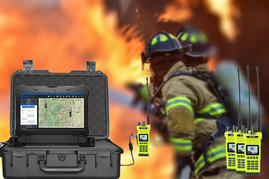
CompassRespond® delivers radio-based location awareness where LMR network infrastructure is unavailable.
Base & Perimeter Security: for monitor patrol teams, response units, and high-value assets across secure facilities
Wildland Firefighting and Forestry Operations: locate crews, vehicles, and equipment across fire lines, staging areas, and remote terrain
Tactical Deployments: maintain real-time awareness of SWAT, border security, interdiction, and special operations teams
Search & Rescue (SAR): coordinate search teams, vehicles, command posts, and rescue activity across difficult terrain
Disaster Response & Emergency Ops: manage responders, mutual aid, mobile assets, and field operations during major incidents
See How CompassRespond Delivers Location Awareness in Disconnected Environments
A self-contained portable system that is deployed in the field to provide tactical mission support for teams responding to active incidents. When there is no or limited land mobile radio coverage or cellular service available, the solution is to bring your GPS tracking system with you. CompassRespond can be deployed with Motorola APX in simplex "Talk Around" mode or with a Motorola PDR8000 portable repeater to provide enhanced conventional LMR coverage over an expanded area. CompassRespond with Esri ArcGIS mapping is the ideal last mile solution for "off the grid" tactical operations to ensure safety and efficiency. Supervisors efficiently coordinate all team members with Motorola radios in real-time on a common operational picture supported by ArcGIS mapping. CompassRespond monitors tactical resources to allow supervisors to quickly re-direct them, as on the ground conditions change — the goal is to get the right resource, to the right place, at the right time. With on-the-fly replay, you can analyze mission progress and make sure the team is meeting mission objectives. The CompassRespond tactical system provides the location data that you need to efficiently manage your resources to protect the lives of your team and the public they serve.
First Responders that need mission coordination anywhere and on demand to support a common operational picture with their assets' real-time location and status without worrying about wireless connectivity. CompassRespond is a complete portable system empowered by Motorola portable and mobile radios. Missions include: SWAT and tactical response teams, Special and Conventional Department of Defense Forces, Law Enforcement and Security Teams, Emergency Search and Rescue Teams, Wildland Fire Fighting Teams, Industrial and Site Security Teams, Disaster Response, Event security, and Crowd control.
CompassRespond is delivered as a complete system with ruggedized laptop, portable rugged case, cables, chargers, map data and software. User supplies Motorola APX P25 portable radio as master and remote units to be carried by the Team.
Yes, the CompassRespond system accepts location information from both APX Series P25 Portable and Mobile radios equipped with built-in GPS tracking support.
Yes, the CompassRespond solution can be used with most P25 conventional repeaters. We recommend the Motorola Solutions PDR8000 Portable Repeater.
One. The system can be carried by one person and deployed in minutes.
System comes with license for 25 radios connected to the host. System can support 100s of radios.
Yes, as an example an APX Series Mobile radio mounted in an incident management vehicle will function as the "gateway" radio collecting the location of your various operators engaged in the mission.
No, currently the CompassRespond solution is designed to support the Motorola APX Series P25 Digital radios.